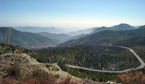
Facts About the San Gabriel Mountains
HIGHEST POINT: Mount San Antonio / aka Mount Baldy
HJIGHEST ELEVATION: About 10,060 feet above sea level
LENGTH: About 70 miles
WIDTH: About 23 miles
COUNTIES: Los Angeles County and San Bernardino County
LOCATION:
Southern California
San Gabriel Mountains National Monument
More then 340,000 acres of federal lands in the San Gabriel Mountains
were designated a United States national monument on October 10, 2014.
The monument is managed by the United States Forest Service
and while the majority of it is in the Angeles National Forest,
about 4,000 acres are within the San Bernardino National Forest.
-
San Gabriel Mountains National Monument
-
San Gabriel Mountains National Monument Fact Sheet (PDF)
-
San Gabriel Mountains National Monument FAQ (PDF)
-
San Gabriel Mountains National Monument Accomplishments (PDF)
-
San Gabriel Mountains National Monument Photos (flickr)
Angeles Crest Highway
-
Angeles Crest Highway Dot Com
-
AA Roads: California State Highway 21
-
Wikipedia "Angeles Crest Highway" Article
-
Wikipedia "California State Route 2" Article
Mount San Antonio / aka Mount Baldy
-
Mount Baldy Visitor Center
-
Mount Baldy Ski Lifts
-
Mount Baldy Zen Center
-
Mount Baldy Chamber of Commerce
-
Mount Baldy Fire Department
-
Mount Baldy Village Church
-
Wikipedia "Mount Baldy Village" Article
-
Wikipedia "Mount San Antonio" Article
Mount Wilson
-
Mount Wilson Observatory
-
Mount Wilson Observatory Web Cam
-
Benjamin's Mountain Article by Marvin Collins - Part 1
-
Benjamin's Mountain Article by Marvin Collins - Part 2
-
Benjamin's Mountain Article by Marvin Collins - Part 3
-
Wikipedia "Mount Wilson" Article
Wilderness Areas
-
Magic Mountain Wilderness Area
-
Pleasant View Ridge Wilderness Area
-
San Gabriel Wilderness Area
-
Sheep Mountain Wilderness Area
Bodies of Water
-
Crystal Lake
-
San Antonio Creek
-
Lytle Creek Middle Fork Wild and Scenic River
-
San Gabriel River (San Gabriel Mountains to Seal Beach)
-
San Gabriel Wild and Scenic River
-
Cogswell Dam and Reservoir on the San Gabriel River
-
Morris Dam and Reservoir on the San Gabriel River
-
San Gabriel Dam and Reservoir on the San Gabriel River
Parks
-
LA Mountains: Parks in the San Gabriel Mountains
Peaks
- Mount San Antonio / aka Mount Baldy (10,068 feet)
- Pine Mountain (9,648 feet)
- Dawson Peak (9,575 feet)
- Mount Harwood (9,552 feet)
- Mount Baden-Powell (9,399 feet)
- Mount Burnham (8,997 feet)
- Throop Peak (9,138 feet)
- Telegraph Peak (8,985 feet)
- Cucamonga Peak (8,859 feet)
- Ontario Peak (8,693 feet)
- Mount Islip (8,250 feet)
- Waterman Mountain (8,038 feet)
- Iron Mountain (8,007 feet)
- South Mount Hawkins (7,783 feet)
- Strawberry Peak (6,164 feet)
- San Gabriel Peak (6,161 feet)
- Vetter Mountain (5,908 feet) fire lookout tower
- Mount Disappointment 1,817 m (5,960 feet)
- Mount Wilson (5,710 feet) Mount Wilson Observatory
- Mount Lowe (5,603 feet) Mount Lowe Railway
- Smith Mountain (5,111 feet))
- Mount Lukens (5,066 feet)
- Echo Mountain (3,207 feet)
Nearby National Forests
-
Angeles National Forest
-
Angeles National Forest Recreational Activities
-
San Bernardino National Forest
-
San Bernardino National Forest Recreational Activities
-
San Dimas Experimental Forest
Lodging
Lodges, Cabins, Resorts
-
Aurelia Harwood Memorial Lodge
-
Mount Baldy Lodge (6777 Mount Baldy Road))
- Wrightwood Hotels
- Buckhorn Lodge and Restaurant (6777 Mount Baldy Road)
- Snow Crest Lodge (CLOSED)
Camping
-
Camp Williams Resort (Cabins, Tent Sites, and RV Sites)
-
Crystal Lake Recreation Area Campground
-
Table Mountain Campground
-
Angeles National Forest Campgrounds
Dining
Restaurants
-
Mount Baldy Lodge Restaurant
-
Top of the Notch Restaurant (access by ski lift or hiking)
-
Mexico Lindo (Wrightwood)
- Other Wrightwood Restaurants
Activities
Bicycling
-
San Gabriel River Trail (base of San Gabriel Mountains to Seal Beach)
-
Cycling the Angeles Crest Century Ride (Route)
-
Cycling the Angeles Crest Century Ride (Description)
Skiing
-
Mount Baldy Ski Lifts
-
Mount Waterman Day Ski and Snowboard Aarea
-
Mountain High Ski Resort
-
Skiing the North Face of Mount San Antonio (Video)
Other Activities
-
Hiking
-
Mountain Biking
- Horseback Riding
- Hunting
- Nature Viewing
- Picnics
- Water Activities (fishing, boating, etc)
Nearby
Bordering the San Gabriel Mountains
-
Antelope Valley
and the
Mojave Desert (in the north)
- Greater Los Angeles Area (in the south)
Nearby Mountain Ranges
-
San Bernardino Mountain Range
-
San Monica Mountain Range
-
Santa Susana Mountain Range
-
San Rafael Hills
-
Santa Ana Mountains
-
Verdugo Mountains
-
Sierra Pelona Mountains
-
Tehachapi Mountains
San Gabriel Mountains Resources
Wikipedia "San Gabriel Mountains" Article
Article with information about
the geography, climate, geology, ecology, transportation,
recreation, major peaks of the San Gabriel Mountains of
California.
San Gabriel Mountains and Rivers
Article on the Web site of the California Wilderness Coalition.
San Gabriel Mountains and Rivers
Article on the Web site of the California Wilderness Coalition.
San Gabriel Mountains Forever Organization
Angeles National Forest Lookout Associationn
About the Mountains of California
Los Angeles County Travel Guide
San Bernardino County Travel Guide
Southern California Travel Guide


